The application from the Interim Neighbourhood Forum was to designate an area covering the whole of Kirkstall Ward (the area shaded light green on the detailed map below).
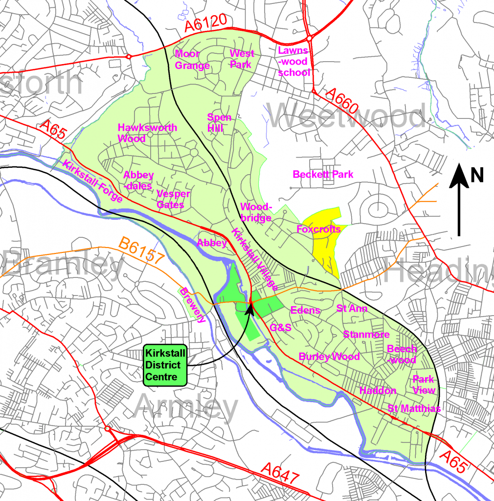
This is a large area, but alternative arrangements are less satisfactory. If the plan boundary falls short of the ward boundary, this leaves “orphan areas” whose interests may be overlooked. Such orphans may also be denied access to significant funds. There is a partial overlap with the previously designated area for the Headingley Neighbourhood Forum around Foxcroft Mount, Queenswood Road, Queenswood Gardens, Queenswood Rise and the southern end of Queenswood Drive. This area is coloured yellow on the map, and the issue is discussed in the LCC Report and Plan prepared on 26 October 2015 (see download list above). The Council decided not to include the disputed area in the Kirkstall Forum for the time being, but urged both Neighbourhood Forums to reach an agreement about future representation. This overlap causes significant problems for Kirkstall residents because the current Headingley boundary splits the operating area for the Queenswood Tenants’ and Residents’ Association (QTARA) in half. Negotiations are necessary to resolve this issue.